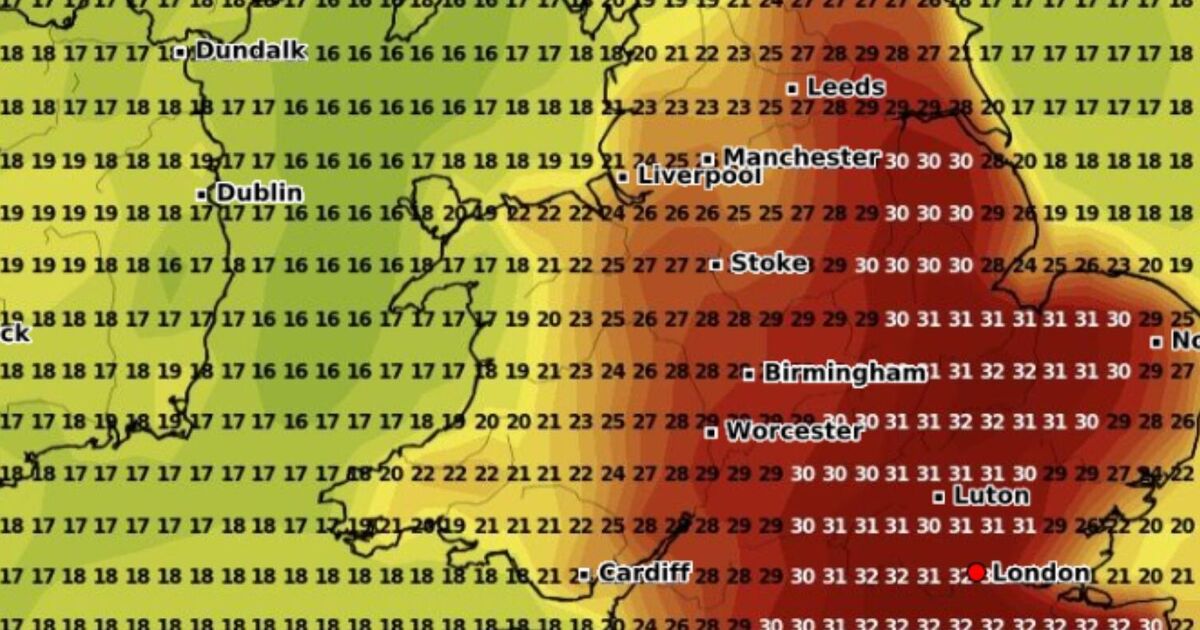
Brits across the country will soon bake under a 30C plus wall of heat four times over the course of this month. WXCHARTS weather maps have turned volcanic red indicating that millions will soon bask in balmy weather and heatwave conditions will once again make an appearance.
During July the UK experienced more unsettled conditions, dampening summer spirits. However, sun-loving Brits will be pleased to hear that a blistering 30C heat bomb is making its way to England on August 10, 11, 13 and 14. On August 10 at 6pm the mercury will rise to a boiling 31C with Gloucester, Worcester and Western Super Mare to see the highest temperatures.
A 30C wall of heat will cover the south west and south east roasting an array of key cities including Bath, Bristol, Oxford and Swindon.
London and the west Midlands will also see temperatures hit 30C whilst the east of England and south Wales will be slightly cooler and are on track to see the mercury hover between 27C-28C.
Fast forward 24 hours to 6pm on August 11 and the £31C heat bomb will have moved to cover the whole of London and the south East and large parts of the east of England.
Major seaside cities including Brighton and Portsmouth will roast under a balmy 31C. Elsewhere, alongside parts of the south west, the east and west midlands will see highs of 28C-29C.
Those in the capital will roast under a sweltering 31C at 6pm on August 13 whilst Surrey, Oxford and Western Super Mare will all see highs of 30C.
Devon, Cornwall and Kent are all forecast to see between 26C-29C. As we go further north Manchester will record highs of 29C alongside Stoke in Central England.
The sizzling conditions will get even hotter on August 14 with temperatures to hit a boiling 32C in Kent, Cambridgeshire and Norfolk.
The rest of the south west will roast under highs of 30C-31C whilst the east of England will also see the mercury hit 30C.
The west and east midlands will not miss out on the heatwave conditions and are on track to record 28C.
There is currently no forecast for the rest of August.

