
Just 12 hours after forming, a short-lived Tropical Storm Arthur degenerated into a remnant low on Wednesday, but models warn its lingering moisture could still trigger redevelopment along the East Coast.
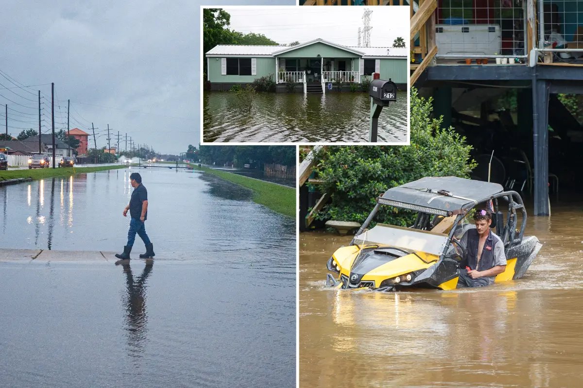
Arthur and its remnants have already battered the Gulf Coast with catastrophic flooding that inundated homes, streets, and offices.
The historic downpours prompted multiple Flash Flood Emergencies, with dangerous impacts remaining a threat to millions on Friday.
According to the FOX Forecast Center, conditions are marginally conducive for any new tropical or subtropical development, placing it at a 10% chance of development over the next two days.
That said, it is unclear if anything were to develop, whether it would get a new name or keep Arthur.
Into Friday, the remnant mid-level spin from Arthur is expected to move across the Southeast and move towards the Carolinas by Friday evening.
As this robust mid-level spin moves offshore, it will sit directly over the warmer waters of the Gulf Stream.
During this period, late Friday, a new area of low pressure could form, bringing some gusty conditions and downpours to Mid-Atlantic coastal regions.
An Area to Watch was designated on Thursday morning just off the East Coast and currently has a low chance of development.
Regardless of the storm’s designation, a significant and potentially life-threatening flash flood threat is expected along the Gulf Coast through late week due to its remnant moisture.
Overall, widespread rainfall totals of 2 to 3 inches are likely across Alabama, Mississippi, and Georgia through Saturday, with locally higher amounts possible where slower-moving downpours set up.
This has prompted Flood Watches across eastern Louisiana, Mississippi, and up through Alabama and Georgia, while a Level 3 out of 4 flood threat spans across parts of the Southeast.
