
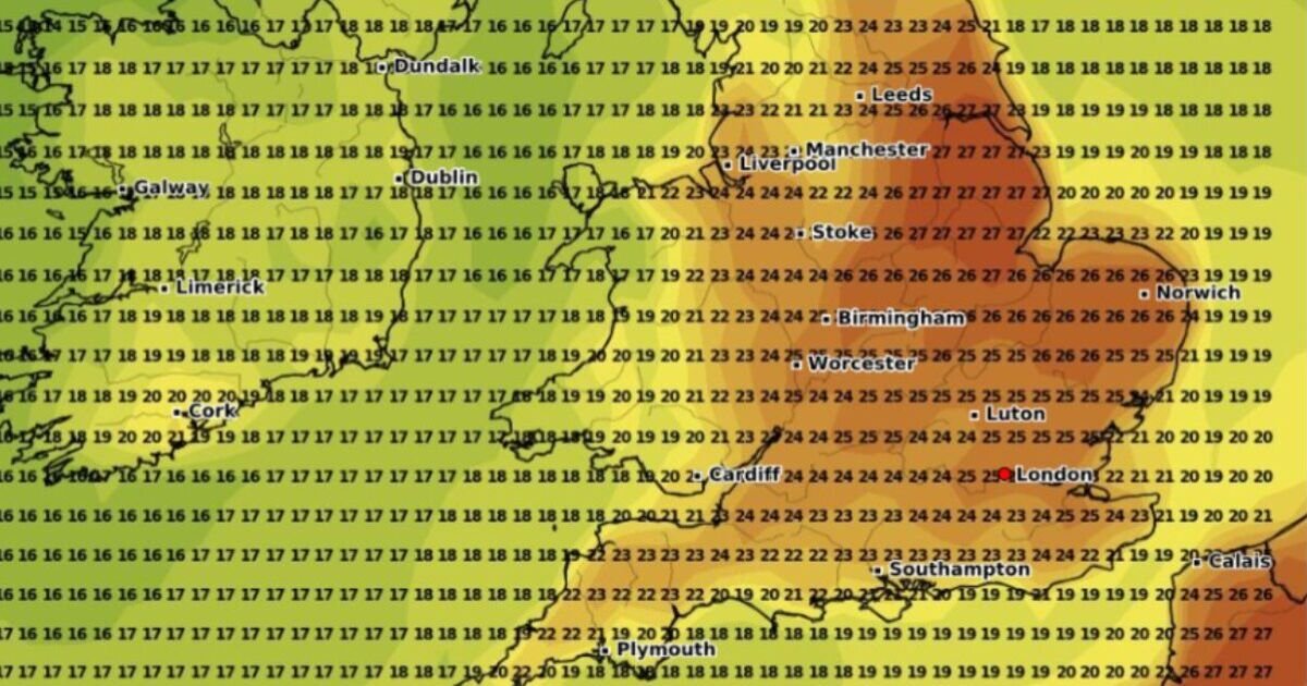

Parts of the UK could see a late summer scorcher next month after a forecasted rainy end to August for many, according to new weather maps. The map by forecaster WXCharts shows 15 areas of England are expected to see temperatures of 25C or more on September 10, with three counties set to see the mercury soar to 27C.
Eastern areas look set to see the hottest conditions. Lincolnshire and possibly parts of Nottinghamshire are predicted to sizzle in 27C, as well as areas of East Yorkshire, including Hull. East Anglia could also see some of the hottest conditions, with Norfolk and some of Suffolk expected to see temperatures of 26C.
Temperatures will likely range between 24C and 25C for most parts of the home counties.
It’s a similar story in London, with a balmy 25C predicted, the weather map shows.
Temperatures are largely expected to range between 22C and 24C in southern areas, with coastal spots likely to be slightly cooler.
The Midlands is also expected to bake, with 26C possible in large parts of the East Midlands.
The West Midlands will too see some of the hottest conditions — it could hit 25C in Birmingham and other areas of the region.
Further north, the heat blast is expected to continue.
Parts of Merseyside and Cheshire could hit 24C, while the mercury could climb to 26C in South Yorkshire.
North-eastern areas are expected to see similar conditions but north-west areas, such as Lancashire and Cumbria will be cooler.
The weather map also shows much of Wales will see temperatures in the 20s, particularly eastern and northern areas.
However, it is expected to be fresher on Wales’ west coast.
Similar temperatures are expected in Northern Ireland, ranging between 17C and 18C.
Most of Scotland was not covered by the weather map.
The Met Office’s long-range weather forecast for September 2-September 11 says: “Changeable and unsettled weather conditions are expected across the UK during this period with low-pressure systems tending to dominate the overall pattern.
“This will mean showers or longer spells of rain will affect the majority of the UK at times. Some heavy rain or showers are expected in places, most often in the west.
“Thunderstorms and hail are also possible, as are some spells of strong winds if any deep areas of low pressure form in the vicinity of the UK.
“Some short-lived spells of drier and more settled weather are also possible at times, especially later in the period.
“Temperatures will likely be close to average or slightly below overall, but may rise above at times in any drier, sunnier spells.”
