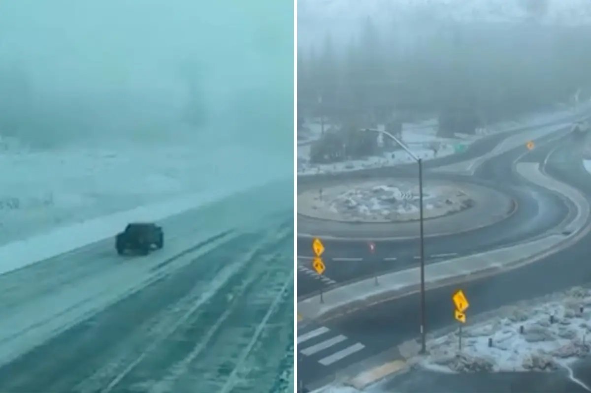


Winter conditions swept into California over the Halloween weekend, delivering mountain snow, highway closures and rain along the coastal areas.
Chain controls remained in place along Highway 88 as of Sunday afternoon, spanning from east of Ham’s Station to five miles west of Picketts Junction due to accumulating snow and icy corridors, KCRA reported.
Snow showers first began blanketing higher elevations of the Sierra Nevada Saturday morning. The National Weather Service Sacramento had put a Winter Weather Advisory into effect beginning at 8 a.m. Saturday through 7 a.m. Sunday for areas above 7,000 feet.
Several high-altitude Sierra passes faced storm closures by Sunday afternoon. Both Monitor Pass (State Route 89) and Sonora Pass (State Route 108) were fully closed due to snow accumulation, according to the Caltrans QuickMap.
Forecasters projected snow levels to hover between 7,000 and 8,000 feet before dropping to 6,000 to 7,000 feet overnight.
A high-country advisory officially expired at 8 a.m. Sunday, with the agency noting that precipitation was tapering off.
“Chance for additional showers and mountain snow through the morning, with conditions slowly drying out this afternoon. Additional snowfall will be minor through the morning (south of Highway 50), with the potential for a few flurries down to 5500 feet,” NWS Sacramento said in its Sunday morning update.
Slush, ice and reduced visibility have made passes over the Sierra and higher ranges treacherous, with motorists cautioned to carry winter gear and check the Caltrans QuickMap before crossing high elevations.
Further south, an atmospheric river system called a Pineapple Express funneled subtropical moisture across Southern California and the Desert Southwest over the holiday weekend.
The system drove coastal rain and high surf into coastal counties. Most major metropolitan regions in Los Angeles and San Diego recorded lighter precipitation amounts, whereas exposed south- and west-facing mountain slopes received up to three inches of rain, according to NWS San Diego.
A Flood Advisory was issued by the NWS San Diego for coastal Orange County, stretching from Huntington Beach south to San Clemente, in effect until 11 p.m. Saturday due to minor urban flooding concerns.
The short bursts of heavy precipitation added to multi-day storm totals that generally ranged from 0.25 to 0.75 inches across most coastal and inland basins, NWS San Diego posted Sunday afternoon.
Over higher elevations, this moisture plume crossed into sub-freezing air, dropping snowfall across the upper peaks of the Sierra and the Rockies and creating slippery passes for motorists traveling Sunday into Monday.
“What’s fueling this soaking is a southward plunge of the jet stream near the West Coast,” said Weather.com’s senior meteorologist Jonathan Erdman.
“It was a damp end to October,” said NWS Sacramento Sunday morning. “More light rain is possible across interior NorCal Tuesday and Wednesday.”
A secondary Pacific system is tracking toward Northern and Central California ahead of Tuesday, bringing returning cloud cover, lower snow levels and another round of scattered mountain snow and valley showers.
Download The California Post App, follow us on social, and subscribe to our newsletters
California Post News: Facebook, Instagram, TikTok, X, YouTube, WhatsApp, LinkedIn
California Post Sports Facebook, Instagram, TikTok, YouTube, X
California Post Opinion
California Post Newsletters: Sign up here!
California Post App: Download here!
Home delivery: Sign up here!
Page Six Hollywood: Sign up here!
