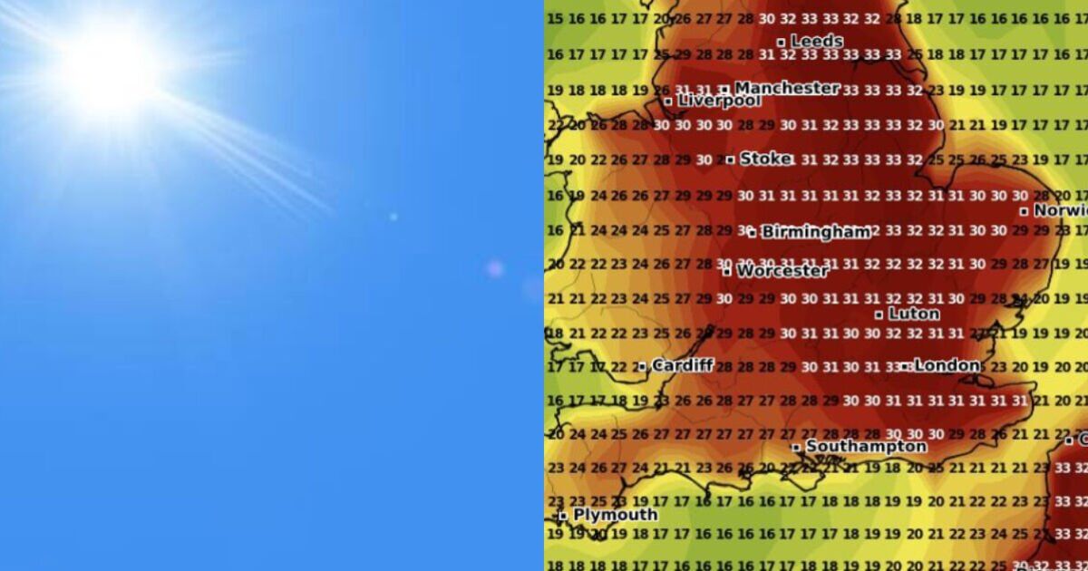
The latest UK weather maps have turned red as Britons look set to bask in more hot temperatures in the coming days before our early summer heatwave meets a wet end. Vast areas of England have been coloured red in a new weather map by WXCharts, indicating scorching temperatures that could reach 33C in the warmest areas.
The map is for 5pm on Sunday June 22 as the Met Office warns much of the UK will experience heatwave conditions by the weekend. It shows hot temperatures upwards of 30C are expected for much of England, including London, south-east, Yorkshire and the north-east, and parts of East Anglia and the north-west. London, York and Lincoln could be among the places to experience sweltering 33C climes, according to the weather map.
The rest of England is still expected to see balmy conditions — much of the south coast and south-west will see conditions in the mid to high 20s, except for parts of Cornwall which will be cooler, especially in coastal areas where temperatures could be as low as 17C.
Wales too will see hot temperatures, particularly in northern and eastern areas, including Wrexham, where temperatures could reach as high as 28C.
Central Wales is also expected to be warm (mid 20s), while Wales’ south and western areas will be cooler, the map suggests.
Northern Ireland will see fine temperatures but is not expected to exceed 23C which is predicted in County Down.
Most of Scotland was not included in the weather map but hot sunny conditions are expected to continue for much of the UK over the coming days.
BBC Weather forecasts show almost entirely sunny days are expected in London, Norwich, Birmingham, Edinburgh for the next 10 days.
A rainy day isn’t forecast for London and Edinburgh until June 27 and June 29 respectively, while Norwich looks on course for continuous days of sunshine for as far as the forecast stretches (June 30).
Cardiff and Belfast are forecast to experience some wet days over the period but will otherwise remain largely sunny with temperatures in the low 20s.
The Met Office says “very warm or hot conditions” are expected over the weekend and into the start of next week.
“Temperatures could remain in the low thirties of Celsius across parts of England, with a small chance of approaching mid thirties in some places,” it says in its forecast.
“Heatwave thresholds may continue to be exceeded across parts of the UK at first. Temperatures overnight will also be very warm and perhaps humid for much of the UK.
“Across the west of the British Isles, cloudier conditions could bring showers with the odd lightning flash. Winds will also be light for most, and moderate around coasts further west.
“From early mid week, signs are the heat will ease, with rain and showers, and less hot conditions, perhaps moving in from the west.”

