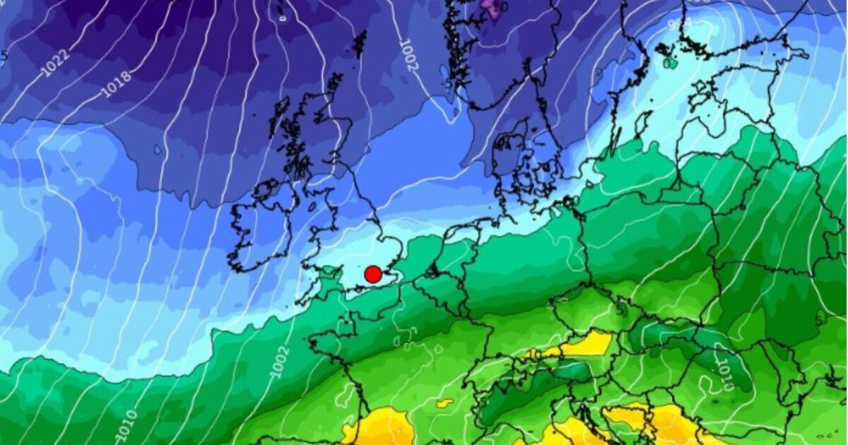
Brits across the UK are bracing for the onset of freezing conditions in just a matter of weeks as winter descends and temperatures plummet. New weather maps by WXCharts, generated on October 8, show a bitterly cold wave of temperatures as low as -1C heading towards the UK from the Arctic on Friday, October 24.
By midnight on October 24, almost the entirety of the UK – apart from a small section of the southwest – turns icy blue in the new weather maps, suggesting temperatures below freezing. In the south of England, temperatures of around 0C are predicted, falling even more the further north you go. Northern Wales, along with midlands cities like Manchester and Leeds, is set to face temperatures of between -1C and 0C, while the Scottish Highlands could see temperatures even lower than that.
A second weather map, generated on Monday, shows predicted minimum temperatures for Wednesday October 22. By midday, temperatures could still be as low as -1C across much of Scotland. Further south, England could see temperatures as low as 5C, with the highest minimum temperatures set to be felt in the east of the country, including 7C in Norfolk and 6C in the Midlands.
Separately, according to the Met Office’s long-range forecast for the period October 22 to November 5, the agency said: “The final third of October will likely see a transition to more unsettled conditions across the UK, with high pressure slipping away, though the timing and manner of this is low confidence.
“Whether this takes the form of successive weather systems moving in from the Atlantic or a rather slower-evolving weather pattern remains to be seen, but there is a greater chance of most if not all places seeing spells of rain or showers and possibly strong winds later in the month, and continuing into the start of November. Temperatures will probably be close to average overall.”
This will descend in the UK after a period of dry and settled weather. Some overnight fog and temperatures near average are predicted for the end of the week and beyond, between October 12 and October 21.
This polar freeze comes as other WXCharts weather maps, also generated on Monday, show that the UK is predicted to see its first snowfall in just a matter of weeks. The forecaster suggests that snow will hit Scotland on October 23 at up to 1cm/hr, before reaching England on October 24. Here, Manchester, Burnley, and areas of North Wales are all expected to see dustings of between 0.3cm/hr and 1cm/hr.
However, the Met Office has quashed ideas of snow in the next few weeks, stating that there is “no indication” of snow in the outlook throughout October. The weather service said conditions appear likely to remain dry and stable next week.
A Met Office spokesperson said: “There is currently no indication of snow in the forecast. The long-range forecast becomes clearer closer to the time, and currently suggests there could be settled conditions next week, thanks to high pressure, and possibly more unsettled weather later in the month. Keep an eye on our forecast to stay up to date as October goes on.”

