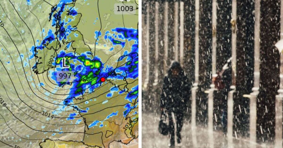
Britain’s long-awaited summer is being put on hold as a Black Sea anticyclone is colliding with an Atlantic storm system. This will result in a weekend of soggy misery, unseasonal winds, and temperatures more reminiscent of October than June.
The atmospheric stalemate is being driven by a swirling low-pressure system anchored just north of the UK. It is being held in place by a sprawling dome of high pressure extending from the Black Sea toward Russia, effectively trapping Britain under a conveyor belt of unsettled Atlantic weather.
“There is a large region of high pressure over the Black Sea towards Russia, and this is helping to keep low pressure stuck to the north of the UK,” said Jim Dale, meteorologist at British Weather Services.
“That low is going to be hanging around through the rest of the week and into the weekend, bringing bands of rain, and at times, some strong winds. In the winds, it will feel cooler, so we are looking at a real bag of spanners in terms of the weather this week.”
According to the Met Office, the UK can expect a wet and windy end to the week. Friday and Saturday will bring frequent, and at times thundery, showers interspersed with short-lived sunny spells.
By Sunday, conditions may ease slightly, but breezier weather will persist, continuing to suppress any sense of early summer.
Weather charts show a tightly packed low-pressure system with central pressure as low as 993mb drawing moisture-laden air across the UK.
Precipitation radar images reveal heavy downpours, especially over central and eastern England, with Manchester and Birmingham appearing in the firing line.
Accumulated rainfall maps show significant totals across western Europe, confirming the widespread nature of this storm system.
The gloomy forecast is particularly striking given the record-breaking spring Britain has just experienced.
Met Office data shows Spring 2025 was the warmest and sunniest on record, with a mean temperature of 9.5C, 1.4C above the long-term average, and the highest since records began in 1884.
Sunshine totals reached 653 hours, 43% above the norm since 1910.
For now, weather models show no immediate signs of a sustained change. The Atlantic low looks set to dominate the synoptic pattern into next week, with the Black Sea high acting like a roadblock preventing the jet stream from lifting north and allowing finer weather to establish.
Until this impasse is broken, Britain remains in the grip of a late-spring deluge. So for those hoping to dust off the barbecue, it may be wise to keep the waterproofs handy a little while longer.


