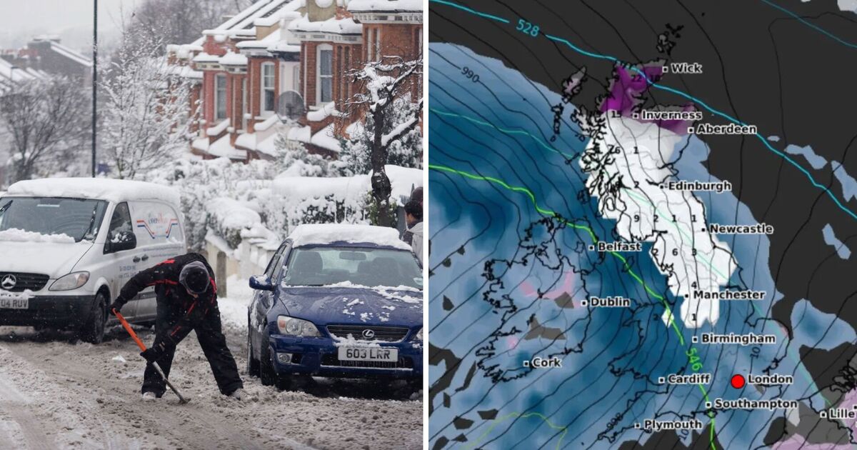
Britain is set to see snow at least twice this week, with swathes of England and Scotland to be hit by a snow dump on Satuday, hot on the heels of the snowfall on Tuesday.
The vast band of snow coming this weekend will stretch some 430 miles, according to WX Charts, from Manchester in the north west of England to Wick in northern Scotland.
The forecast is predicting that on November 23, virtually all of northern England is set to be blanketed, along with almost the entirety of Scotland.
North Wales is also expected to get a good dusting, and Northern Ireland may see some isolated snow showers too.
Unsurprisingly, the heaviest of the snow will be seen in high ground of northern Scotland. The Scottish Highlands, home to Britain’s tallest mountains, may see upwards of ten inches of snow, according to the forecaster.
The WX Charts prediction has also been echoed by the Met Office.
Met Office Deputy Chief Meteorologist Mike Silverstone said: “Winter hazards will gradually diminish through the weekend, though they will hold on longest in northern Scotland. Substantial snowfall is expected across much of northern England and Scotland for a time on Saturday, mainly over higher ground.
“Rain on Saturday and into Sunday is likely to be impactful for some, which has resulted in warnings being issued for Wales and parts of the southwest. Widely, 50-75 mm is expected within the warning areas, but in excess of 150 mm of rain is possible over high ground in south Wales. Strong winds are likely to exacerbate impacts and brings the potential for travel disruption as well as flooding for some.”
Thursday, November 21 until Monday, November 25
Today:
Thursday kicks off with a frosty, potentially icy start for most, accompanied by sunny spells and wintry showers in areas exposed to the northwesterly wind. The southwest will see more cloud cover, with bouts of rain and hill snow passing through.
It’s set to be rather breezy.
Tonight:
The north of the UK can expect continued wintry and blustery showers, while further south conditions will be drier with clear skies. A widespread frost is anticipated to develop inland from the coasts.
Friday:
Friday morning will bring another frosty, possibly icy start, with sunshine and wintry showers persisting in exposed regions. Showers and winds are expected to gradually ease as the afternoon progresses.
Outlook for Saturday to Monday:
The weather takes a turn over the weekend, becoming wet and windy across the board on Saturday, with initial hill snow and blustery showers continuing into Sunday and Monday. Temperatures will rise slightly on Saturday and Sunday, before cooling down again as we head into Monday.


