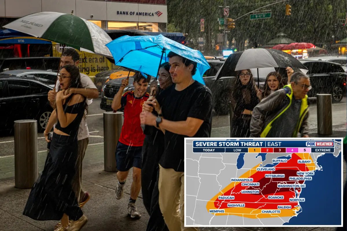


As a multiday severe weather event shifts eastward on Tuesday, an exceptionally active day is shaping up across much of the eastern US.
Over 116 million people are in the threat zone as severe storms bring the risk of tornadoes, damaging winds, and large hail, along with heavy rain that brings an increasing risk of widespread flash flooding.
The multiday threat kicked off Monday, impacting portions of the Upper Midwest throughout the afternoon and evening with multiple tornado-warned storms, large hail, and damaging winds.
Some of the highest wind gusts were reported in Iowa, where Sheffield recorded 80 mph. Meanwhile, Watson, Michigan, saw 3-inch hail.
As severe weather shifts eastward on Tuesday, conditions mirror Saturday’s high-impact event of severe storms and flash flooding across parts of the region.
A very active pattern now brings the potential for both severe storms and flash flooding across a massive stretch from the Midwest to the Northeast.
The severe weather threat has been upgraded to a Level 3 out of 5 for 35 million people, with another 50 million under a Level 2 threat on Tuesday.
The first round of storms is expected to develop during the morning hours, stretching from eastern Virginia up into the Tri-State area and southern New England.
While this will be the weaker of the two rounds, these storms will still be capable of producing gusty winds and torrential downpours.
Flash flooding is also possible—especially in urban areas—and could impact the morning commute.
“Significant flash flooding is also on the table, and we could be looking at more scenes of underwater roads and flooded subways,” the FOX Forecast Center said.
But more than anything, this initial wave will set the stage for the main event later in the day.
Severe Thunderstorm Threats
The primary line of thunderstorms will take shape by mid-morning along a pre-frontal trough ahead of the main cold front, extending from the upper Ohio Valley up into western New York.
These storms will gradually intensify as they track east through the afternoon, approaching the I-95 corridor during or just after the evening rush hour.
Swaths of damaging winds capable of knocking down trees will be the primary threat, though a few tornadoes are also possible.
According to the FOX Forecast Center, “The highest confidence for tornado development spans western New York down into eastern Pennsylvania.”
Hail is also likely in this region, extending back toward the middle Ohio Valley. However, the greatest risk for widespread, high-impact damaging winds will focus across the Mid-Atlantic states.
Flash Flooding Risk
Additionally, the growing potential for flash flooding is a major concern.
Tuesday’s setup is remarkably similar to last Saturday, which triggered significant flooding across New York City, New Jersey, and western Pennsylvania.
Atmospheric moisture will support peak rainfall rates as high as 2.5 inches per hour—nearly half the monthly average for July.
Heavy rain of this intensity is concerning on its own, but it will be falling on ground already saturated from Saturday’s downpours, the FOX Forecast Center highlights.
The main round of storms will reach the I-95 Megalopolis between 6 p.m. and 8 p.m. before pushing offshore by midnight.
Additionally, the same storms will also be capable of producing torrential rain, especially along the I-95 corridor from the Delmarva Peninsula into southern New England.
