By using this site, you agree to the Privacy Policy and Terms of Use.
Accept

Amed Post

Breaking News,magazine, sport, life

Notification Show More
Font ResizerAa
Reading: Holiday weekend snow could impact several major cities along I-95 corridor in the Northeast
Share
Font ResizerAa

Amed Post

Breaking News,magazine, sport, life

Search
Have an existing account? Sign In
Follow US

Holiday weekend snow could impact several major cities along I-95 corridor in the Northeast

amedpost
Last updated: January 16, 2026 10:12 am
amedpost
Published: January 16, 2026
Share
SHARE


Though many portions of the densely populated Interstate 95 corridor are seeing below average snow totals this winter, two separate systems could bring light snow from Washington, DC north to Boston through this weekend and into Martin Luther King Jr. Day.

Starting Saturday, an arctic front is forecast to swing into the Northeast, paving the way for flakes that could fall in several major cities in the region.

The Poconos in Pennsylvania north to Upstate New York and into New England are in the bullseye to see the highest snow totals, according to the FOX Forecast Center.

Washington DC to Philadelphia could see the highest snow totals closer to the I-95 corridor, which could create transportation concerns along one of the country’s most popular highways.

Snow could begin as early as Friday night and continue into Saturday morning, with some locations potentially receiving a quick 1 to 2 inches.

Heavier totals will be confined to the higher elevations to the west of the I-95 corridor where temperatures will be coldest.


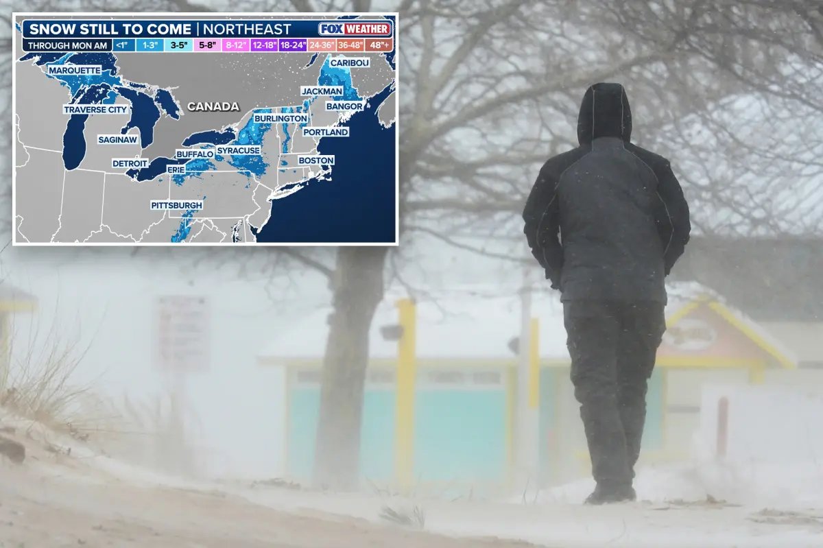
Two systems could bring light snow from Washington, DC, to Boston through the weekend and into MLK Day, despite below-average snowfall along much of the I-95 corridor.
Two systems could bring light snow from Washington, DC, to Boston through the weekend and into MLK Day, despite below-average snowfall along much of the I-95 corridor. Fox Weather

An arctic front is forecast to move into the Northeast starting Saturday, bringing the chance of snow to several major cities.
An arctic front is forecast to move into the Northeast starting Saturday, bringing the chance of snow to several major cities. AP

While not everyone will see notable accumulation, the best chances of seeing snow cover lies in the interior regions northwest of the major I-95 cities, including in Syracuse, New York. 

A few flakes are possible even in New York City and Boston before precipitation ends later Saturday.

The FOX Forecast Center is monitoring the next chance for snow hot on the heels of the weekend blast bringing winter weather into the Northeast Friday into Saturday.

Late Sunday into Monday morning, an area of low pressure is expected to race up the Eastern seaboard, potentially bringing another round of light snow along the coast.

Cheese will last ‘significantly’ longer without mould if stored with 1 item
Nets’ Danny Wolf makes most of long-awaited opportunity with big performance
Three teens and woman, 20, arrested over M&S, Co-op and Harrods cyber attacks | UK | News
Scientist murdered in front of fiancée on Puerto Rico vacation by masked men firing AR-15s: reports
Graham Platner drops out of Maine Senate race after rape claim

Subscribe

Subscribe to our newsletter to get our newest articles instantly!

[mc4wp_form]

Share This Article
Facebook Email Print
Leave a Comment

Leave a Reply Cancel reply

Your email address will not be published. Required fields are marked *

© AMED POST Design Company. All Rights Reserved.
Welcome Back!

Sign in to your account

Username or Email Address
Password

Lost your password?