By using this site, you agree to the Privacy Policy and Terms of Use.
Accept

Amed Post

Breaking News,magazine, sport, life

Notification Show More
Font ResizerAa
Reading: Hurricane Isaias makes landfall in Florida Panhandle as extreme weather slams area
Share
Font ResizerAa

Amed Post

Breaking News,magazine, sport, life

Search
Have an existing account? Sign In
Follow US
News

Hurricane Isaias makes landfall in Florida Panhandle as extreme weather slams area

amedpost
Last updated: October 10, 2026 1:57 am
amedpost
Published: October 10, 2026
Share
SHARE


Hurricane Isaias made landfall along the western Florida Panhandle near Destin as a Category 2 storm late Friday evening, packing maximum sustained winds of 105 mph.


Follow live updates on Hurricane Isaias to track the storm’s path, get the latest news, and more


The National Hurricane Center confirmed the center crossed the coast around 8:30 p.m. CDT, with the eye moving inland while hurricane-force winds and life-threatening storm surge battered coastal communities from southern Alabama into the Florida Panhandle.


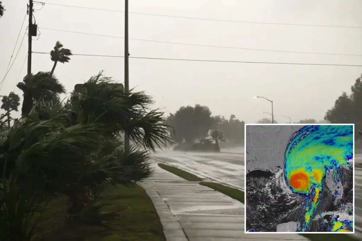
An empty road during Hurricane Isaias in Pensacola, Florida.
An empty road is seen as the strong winds of Hurricane Isaias hit Pensacola, Florida on Oct. 9, 2026. AFP via Getty Images

A storm surge warning is in effect for the mouth of the Mississippi River to the Suwannee River in Florida, according to the National Weather Service and a hurricane warning is in effect from Ocean Springs, Mississippi to the Bay/Gulf County Line in Florida.

Residents under hurricane and storm surge warnings faced rapidly deteriorating conditions as the system pushed northward at about 18 mph.


Satellite image of Hurricane Isaias approaching the southeastern US coast.
A graphic map shows Hurricane Isaias as a Category 3 Major Hurricane with maximum sustained winds of 120 mph on Oct. 9, 2026. USA TODAY Network via Reuters Connect

Forecasters warned of 6 to 9 feet of inundation along portions of the coast east of the landfall point, along with damaging winds expected to extend well inland into southern Alabama.

Heavy rainfall of 4 to 8 inches, with isolated totals up to 15 inches, raised the risk of flash flooding across the region through the weekend as Isaias weakens and tracks toward the Tennessee Valley.

This is a developing story. Please check back for updates.

Trump warns Iran at UN he may ‘drive them into hell,’ says US ‘settling years of unfinished business’
Psycho South Carolina mom stabs her two kids over 50 times in unhinged attack that leaves one facing amputation
Kentucky man asleep in cemetery crushed death in hit-and-run
Jessica Tisch says Jewish NYers have ‘partner in the NYPD’
DoorDash delivery drones will soon be a reality in California

Subscribe

Subscribe to our newsletter to get our newest articles instantly!

[mc4wp_form]

Share This Article
Facebook Email Print
Leave a Comment

Leave a Reply Cancel reply

Your email address will not be published. Required fields are marked *

© AMED POST Design Company. All Rights Reserved.
Welcome Back!

Sign in to your account

Username or Email Address
Password

Lost your password?