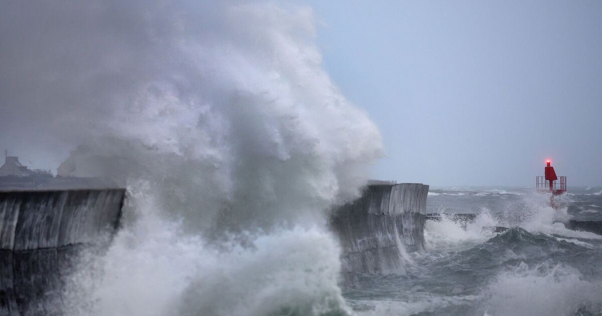
Large parts of England and Wales are set to be pelted with heavy rain and powerful winds as Storm Benjamin arrives in the UK. The Met Office has put out four yellow weather warnings for wind and rain across the two nations, all of which are already in effect.
Two yellow warnings for rain came into effect from midnight on October 23, include one covering dozens of local authorities across East Midlands, East of England, London & South East England, North East England, South West England, Wales, West Midlands, Yorkshire & Humber until 6pm.
The national weather agency warns residents in these areas to expect:
- Spray and flooding on roads leading to difficult driving conditions and increased chance of accidents, making journey times longer
- Public transport affected in places with some journey times taking longer
- Flooding of a few homes and businesses is likely
The second covers several local authorities in East Midlands, East of England, and Yorkshire & Humber and is place until 9pm today (Thursday, October 23).
Meanwhile a yellow warning for wind has been in place since 3am covering dozens of local authorities across East Midlands, East of England, London & South East England, and Yorkshire & Humber. It will remain in place until 11.59 today.
A yellow warning for wind also came into effect at 6am covering 11 local authorities across South West England and Wales.
Residents are warned:
- Some delays to road, rail, air and ferry transport are likely
- It’s likely that some coastal routes, sea fronts and coastal communities will be affected by spray and/or large waves
- Probably some bus and train services affected, with some journeys taking longer
- Some isolated short term loss of power and other services is possible
- Delays for high-sided vehicles on exposed routes and bridges likely
It will remain in place until 3pm today.
The national weather agency warned there is a small chance that “injuries and danger to life could occur” from both large waves and beach material being thrown onto sea fronts, coastal roads and properties as well as from flying debris due to the strong winds.
Dan Harris, deputy chief meteorologist at the government agency said: “Low pressure moving across the south of the UK on Thursday will bring both a spell of heavy rain and areas of strong winds.”
In a press release announcing the warnings on Tuesday, Met Office Chief Meteorologist, Rebekah Hicks said: “Low pressure moving across the south of the UK tomorrow will bring both a spell of heavy rain and areas of strong winds.
“The rain is expected to arrive from the southwest this evening, before spreading northeast to many parts of England and Wales during Thursday, leading to difficult driving conditions and the risk of flooding in a few places. At the same time, winds are expected to pick up along southern coastal areas.
“However, it is not until Thursday morning that significantly strong north-westerly winds will first begin to affect parts of the west with gusts of 45 to 55 mph, locally 55mph around coasts expected.
“At the same time, northerly winds are expected to develop more widely across eastern areas, with gusts of 50-60 mph fairly widely and up to 70 mph near some coasts. Should Storm Benjamin be at the stronger end of expectations, there is a small chance of wind gusts very locally exceeding 70 mph for a time.
“It is worth noting that there is a greater than usual uncertainty surrounding the track and intensity of this low-pressure system, so the public should stay up to date with the latest forecasts and warnings as the situation evolves, with adjustments to the forecasts likely at short notice.”
Away from the warning areas Thursday will be a day of sunny spells and blustery showers, these sometimes merging into longer spells of rain. Temperatures will be a little below average, but it will feel rather cold with brisk winds for most.

