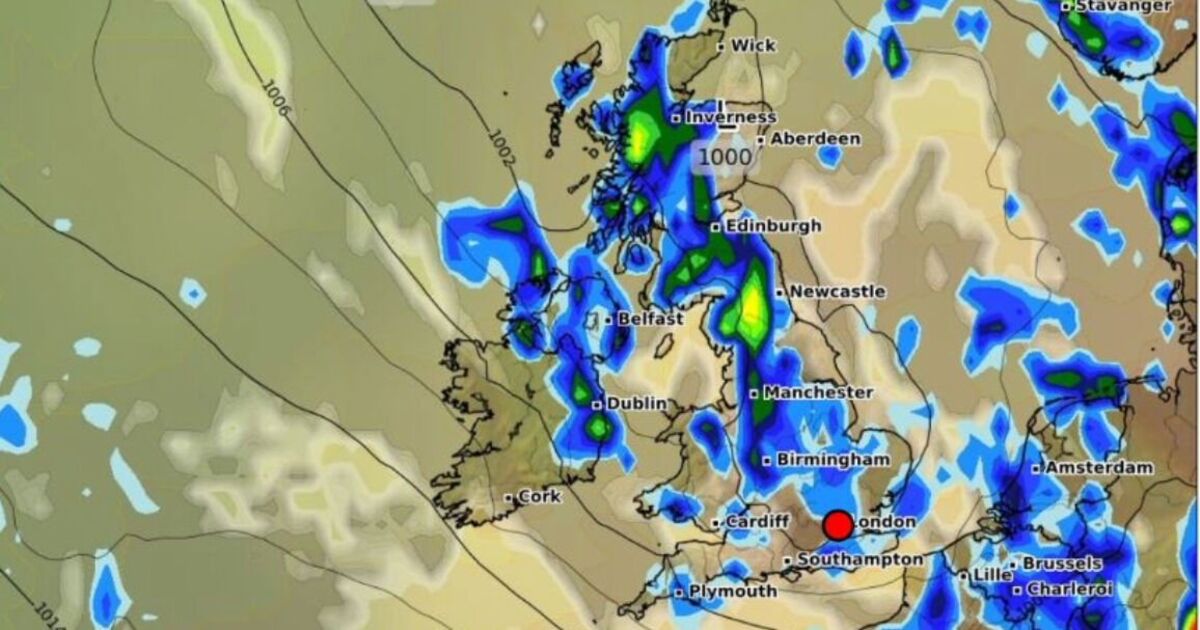
Large areas of the UK are expected to see showers next week, according to a new weather map. A wall of rain is predicted to stretch around 582 miles from England’s south coast to some of the most northern areas of mainland Scotland.
The map by WXCharts.com for the afternoon on Monday, July 21, shows rainfall is expected across almost all of Scotland and Northern Ireland, with large areas of England and some of Wales also set to see some. It is due to follow some stormy conditions as the Met Office issues yellow weather warnings for Northern Ireland and much of England from Friday. According to the new weather map for Monday afternoon, a continuous line of rain is expected through England, largely affecting more central areas, and up to the north of Scotland.
Light rain is expected around coastal areas of Hampshire and Kent, such as Dover, extending into London and some of the Home Counties.
The East and West Midlands — where a drought was declared earlier this week — are predicted to largely be covered by light showers, while the north-west will likely see some heavier conditions.
Manchester could see more than 1mm rain per hour, while areas around the Pennines could see the heaviest rainfall in England of up to 3mm per hour.
Other areas of England will likely see pockets too, including coastal areas of Essex and Suffolk, and some of the south-west.
Much of Scotland is also expected to be affected, except for most of the west coast.
The rainfall is predicted to be largely light, with only a small portion of Invernesshire set to see 3mm per hour.
The showers, which are expected to cover both Edinburgh and Glasgow, could extend as far as the most north-western point of mainland Scotland — Cape Wrath.
Almost all of Northern Ireland will see some drizzle on Monday, according to the new weather map, while some parts of Wales will also see some very light conditions.
The Met Office’s UK forecast for Sunday to Tuesday warns of rainy conditions following a weekend when bad weather is expected.
The forecast says: “Remaining unsettled with further heavy and perhaps thundery showers on Sunday and Monday. Chance of some more persistent rain arriving late Tuesday. A little less warm, though still feeling humid.”

