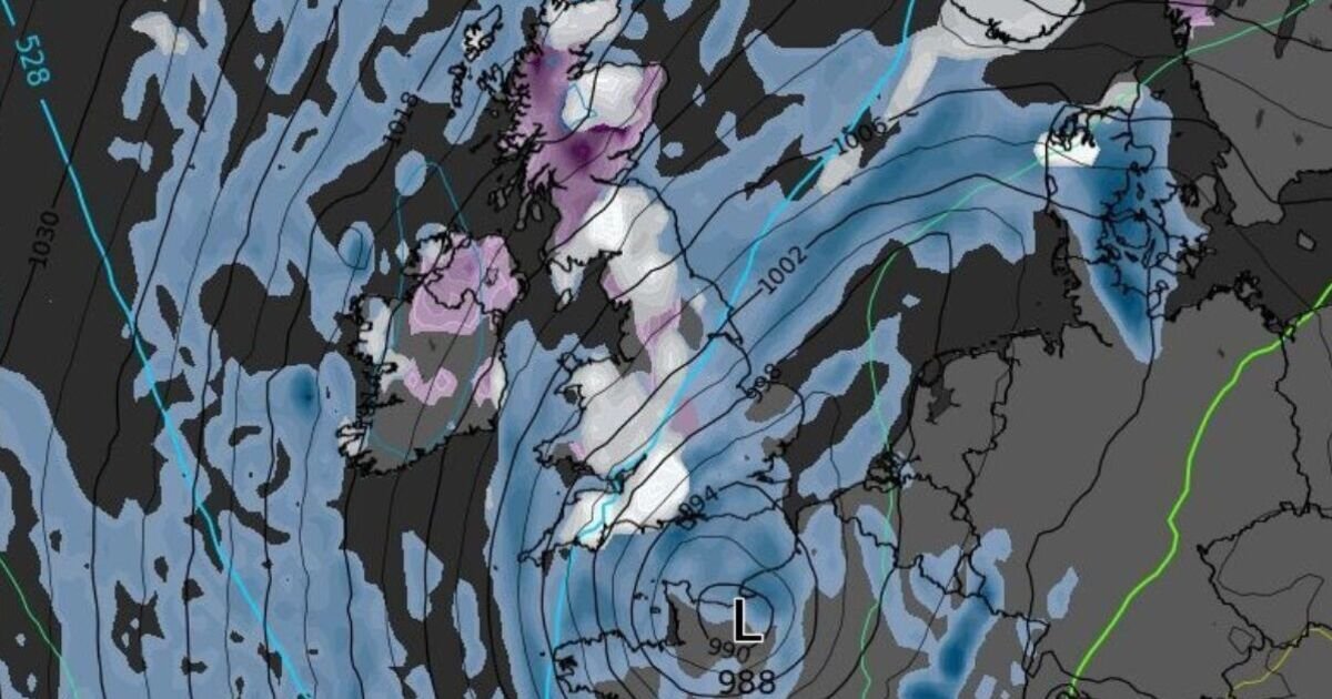

A great stretch of the UK could be hit by heavy snowfall in under a fortnight as a wintry weather front takes hold. Weather maps generated by WXCharts suggest a blizzard with depths of up to 10cm could wreak havoc on the country by mid-November. The seasonal forecast is expected to take effect from Monday, November 17, with snowfall initially concentrated in Scotland and the northern regions.
Throughout the day, it could stretch right across to southwest England, however, blanketing the entire western coastline in white. Temperatures could also plummet from unusual highs of 17C to lows of -10C as the month nears its end, setting the scene for a chilly and icy winter.
The disruptive front could continue through to the end of the month, with weather maps painting the whole of the UK a freezing blue until November 26.
While the entirety of the country is likely to feel the chill and its inevitable impact on transport and safety, the front is expected to hit northern England, Scotland and Northern Ireland hardest, with snow depths of 10cm right off the bat.
It will follow an unusually warm start to November, with temperatures in parts of the country rivalling those of warmer climes in southern Europe and rising to almost 20C.
United Nations scientists have said 2025 is on track to the the second or third warmest globally after an “unprecedented streak” of warmth. The Met Office also confirmed that this summer was the warmest in UK records after the mercury averaged 16.10C.
This evening and tonight:
Wet and windy in northern England and Scotland, with some rainfall in southwestern coastal areas. Cooler overnight temperatures in southwestern England and Wales.
Saturday:
A foggy start, clearing to a sunny and dry day for most. Light showers are possible in the west.
Outlook for Sunday to Tuesday:
Temperatures are generally cooling, and the weather is becoming more changeable across the board. Rain is expected to move eastwards throughout the week, with heavy showers on Monday and Tuesday, especially in the west.
